

Comprehensive Guide to Geological Exploration: Techniques and Tools
Geophysical and Geochemical Surveys: Techniques and Applications
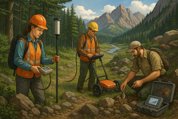
Geophysical and geochemical surveys are powerful tools used in various industries, from environmental studies to mineral exploration. These surveys play a crucial role in understanding the properties of the Earth’s subsurface, helping scientists, geologists, and environmental experts unravel the mysteries hidden beneath the surface.
Geophysical surveys utilize methods like seismic reflection, ground-penetrating radar, and magnetic surveys to map underground structures, detect anomalies, and identify valuable resources. On the other hand, geochemical surveys analyze the chemical composition of soil, rocks, and water to provide insights into the presence of minerals, contaminants, and overall environmental health.
The applications of these surveys are vast and diverse. In the oil and gas industry, geophysical surveys help locate potential reservoirs, optimize drilling operations, and enhance resource extraction. Environmental scientists use geochemical surveys to assess soil quality, monitor pollution levels, and plan remediation strategies for contaminated sites.
Whether it’s mapping fault lines, searching for groundwater sources, or exploring new mineral deposits, geophysical and geochemical surveys are indispensable techniques that drive innovation and decision-making across multiple fields. By combining these advanced methods with modern technology, experts can unlock a wealth of information about the Earth’s subsurface, paving the way for sustainable resource management and environmental conservation.

The Importance of Topographic Mapping in Geological Exploration
Key Insights and Strategies
Topographic mapping plays a crucial role in geological exploration by providing detailed information about the surface features of the Earth. By understanding the topography of an area, geologists can identify geological structures, such as faults, folds, and intrusions, that might indicate the presence of valuable mineral deposits.
Additionally, topographic maps help geologists in planning exploration activities, determining safe and accessible routes, and assessing the environmental impact of mining operations.
Step-by-Step Guide
- Step 1: Start by obtaining topographic maps of the area you plan to explore, either from governmental agencies or specialized mapping companies.
- Step 2: Analyze the topographic features to identify potential geological formations and mineralization zones.
- Step 3: Utilize advanced geospatial technologies like GIS and remote sensing to enhance your mapping efforts and data interpretation.
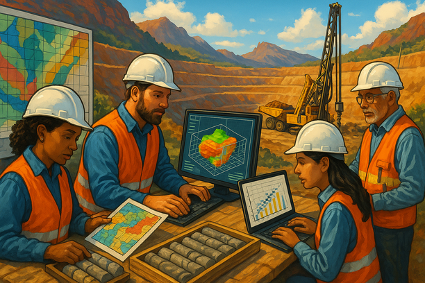
Mineral Resource Estimation: Methods and Best Practices
Understanding Geological Data
Conduct a thorough analysis of geological data such as drill core samples, geophysical surveys, and geological maps to ensure accurate estimation.
Choosing the Right Estimation Method
Select the most suitable estimation method based on the type of deposit, data availability, and project stage, whether it’s kriging, inverse distance weighting, or other techniques.
Quality Assurance and Quality Control (QA/QC)
Implement robust QA/QC procedures to validate data integrity, prevent errors, and ensure reliable resource estimates.
Transparency and Documentation
Document all procedures, assumptions, and parameters used in the estimation process to enhance transparency, credibility, and reproducibility.
Regular Reviews and Updates
Review and update resource estimates regularly to incorporate new data, improve accuracy, and adapt to changes in project conditions or methodologies.
Frequently Asked Questions (Q&A)
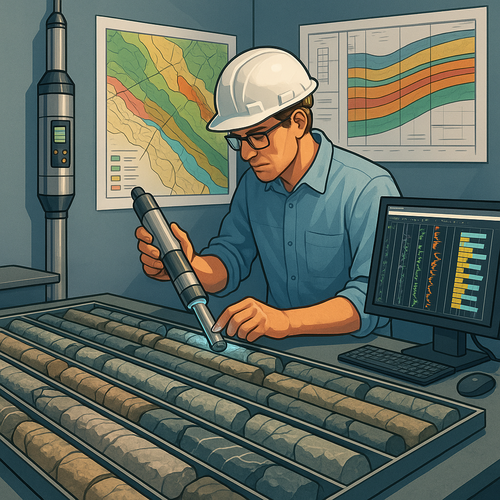
Q: What’s the biggest challenge with Borehole Logging and Core Analysis: Essential Steps for Geological Model Validation?
A: One of the primary challenges associated with borehole logging and core analysis in the geological model validation process lies in ensuring the accuracy and reliability of the collected data. Geologists face complexities in interpreting the information obtained from boreholes and cores to develop a precise geological model.
Q: How can I make Borehole Logging and Core Analysis more effective?
A: To enhance the effectiveness of borehole logging and core analysis for geological model validation, it’s crucial to meticulously document and analyze the data. Implementing advanced logging techniques, cross-referencing multiple data sources, and utilizing digital tools for comprehensive analysis can lead to more reliable results and significantly improve the SEO impact of the geological model.