

Comprehensive Guide to Geological Exploration: Methods and Techniques
Understanding Geophysical and Geochemical Surveys
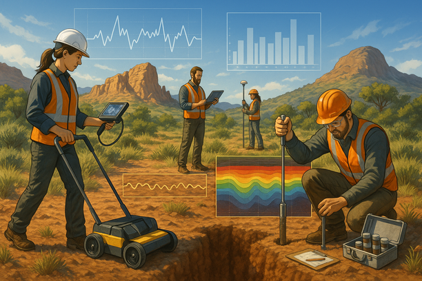
Geophysical and geochemical surveys play vital roles in uncovering valuable insights beneath the Earth’s surface. Geophysical surveys utilize various techniques to study the physical properties of rocks, soil, and other subsurface materials. These surveys are crucial in identifying potential mineral deposits, groundwater resources, and geological structures.
On the other hand, geochemical surveys focus on analyzing the chemical composition of rocks and soil to understand mineralization patterns and environmental conditions. By examining the distribution of elements and minerals, geochemists can identify areas with high mineral potential or assess environmental impacts.
These surveys are essential tools in industries like mining, environmental monitoring, and geotechnical engineering. They provide critical data for decision-making processes related to resource exploration, land use planning, and environmental protection. Understanding geophysical and geochemical surveys is key to unlocking the Earth’s hidden treasures and ensuring sustainable development.

The Role of Topographic Mapping in Mineral Exploration
Key Insights and Strategies
Topographic mapping plays a crucial role in mineral exploration by providing valuable insights into the geological features of a region. By creating detailed maps that show elevation, terrain, and surface features, geologists and exploration teams can identify potential mineral deposits based on the land’s characteristics.
Step-by-Step Guide
- Step 1: Conduct a detailed topographic survey of the area using satellite imagery, drones, or field measurements.
- Step 2: Analyze the topographic data to identify geological structures, potential mineralization zones, and areas with high mineral exploration potential.
- Step 3: Combine the topographic maps with geological data and conduct ground surveys to validate potential mineral deposits before initiating costly exploration operations.
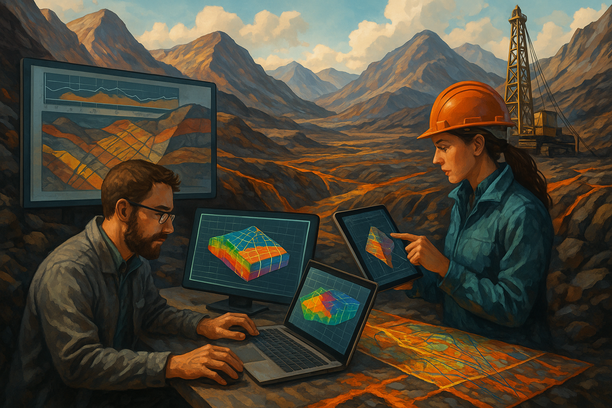
Methods for Accurate Mineral Resource Estimation
Mineral resource estimation is a crucial process in the mining industry, determining the value and feasibility of mineral deposits. To ensure accuracy, various methods are employed.
Geostatistics:
Utilizing spatial statistics to analyze and interpolate mineral data, geostatistics helps in estimating mineral resources with spatial variability. By understanding the spatial distribution patterns, accurate estimates can be obtained.
Multi-Indicator Kriging:
This advanced technique combines multiple indicators to estimate mineral resources. By considering various parameters simultaneously, such as grade and geological features, a more accurate estimation can be achieved.
Machine Learning:
Modern technologies like machine learning algorithms can enhance the accuracy of mineral resource estimation. By analyzing large datasets and identifying patterns, machine learning models can provide more precise estimates.
Modeling and Simulation:
Using 3D modeling and simulation software, mining engineers can create virtual representations of mineral deposits. By simulating various scenarios, they can refine estimates and improve accuracy.
Common Pitfalls to Avoid:
When estimating mineral resources, it’s essential to avoid common pitfalls like insufficient data quality, improper interpolation techniques, and biased sample selection. Ensuring high-quality data, using appropriate methods, and maintaining objectivity are key to accurate mineral estimation.
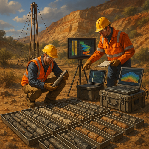
Borehole Logging and Core Analysis for Geological Model Validation
Frequently Asked Questions (Q&A)
Q: What’s the biggest challenge with Borehole Logging and Core Analysis for Geological Model Validation?
A: One common challenge is ensuring the accuracy and reliability of the data obtained through borehole logging and core analysis to validate geological models effectively.
Q: How can I make Borehole Logging and Core Analysis for Geological Model Validation more effective?
A: To enhance the effectiveness of borehole logging and core analysis for geological model validation, it is essential to use advanced technology, conduct thorough data interpretation, and incorporate multidisciplinary insights to improve the overall SEO impact of the geological studies.